

Our beautiful city is planned and then built. Only now do we see what was envisioned in the 2004 Canberra Spatial Plan.
The ACT Government is challenged to find space for Canberra’s growing population. There is nothing new about this. The 2004 Canberra Spatial Plan was a strategic approach and the construction is now half finished – a demonstration that urban planning and city building takes decades. The last 2020 ACT Parliamentary Agreement confirmed that future “housing” will be split between 70% infill and 30% greenfield. The infill areas will be close to town centres and civic. The greenfield developments are the smaller component of new housing supply and the Molonglo Valley a significant part of it.
The Molonglo Valley was the brainchild of the 2004 Canberra Spatial Plan. The end of the 2004 Canberra Spatial Plan will be found in the completion of the Molonglo Valley in 2040-2050.
Spatial planning: why it matters
The areas favoured for urban development are located as close to Civic as possible. The closer to the city, the greater the urban intensification (pink line). The blue circle shows the urban growth containment area which goes as far south as Greenway, Tuggeranong, but notably not past that.
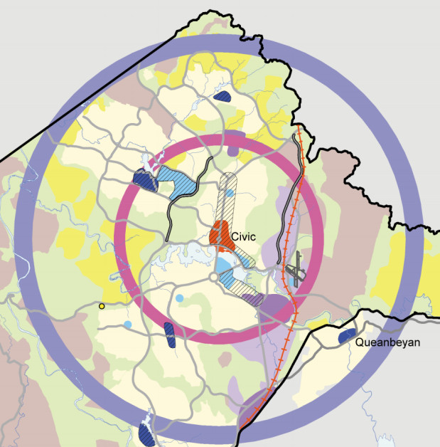
Map 2: future urban areas are marked in yellow and the water catchment area with a dotted blue. Notably, the ACT border falls a little short of the end of the Canberra water catchment area.

The urban capital area is larger than one would first think. Environmental protection and the ambition for a compact Canberra will mean that the Molonglo Valley will be the last of the large estates for a very long time. Canberra will grow upwards and not outwards.

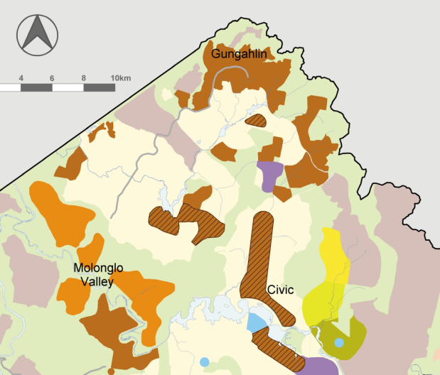
Back in 2004, Gungahlin was the focus for greenfield development, however, in 2021 Gungahlin is largely completed and the Suburban Land Agency has moved onto the Molonglo Valley and will remain there for the next 30 years!

Map 6 shows future residential in brown and orange colours. The “short term” greenfield (brown) is largely completed. The medium term (orange) is now under construction in the Molonglo Valley. The future employment corridor (yellow) is along the Majura Parkway.
Map 8 shows “future” public transport and connections. The Majura Parkway and Gungahlin Parkway, including the upgrade of the Glenloch Interchange, are already complete. John Gorton Drive is still under construction but arguably, that too, will end with the bridge in 2025.

Map 11 shows the “restricted defence clearance zone” (green) north of the airport. Any development of the Kowen Forest is limited by the lack of connection to the rest of Canberra – and it also lies outside the urban growth containment line too (blue circle shown in map 1).

